


Melkeok subdivision masterplan
INTRODUCTION
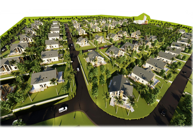
The project is the 1st phase which involve 25 lots out of 100 lot residential sub-division where each lot is 1000 square meter in area. The project site is located on hillside of Melekeok State in the Republic of Palau. This report is prepared to understand the overall grading plan of the entire subdivision along with the conceptual infrastructure plan elaborating on the key assumptions for design and the preliminary single line diagram of the key infrastructure for the entire subdivision
Yes I'm Interested
SITE ANALYSIS
Melekeok is located on the eastern coast of the largest island in the Palau Archipelago, Babeldaob or Babelthuap in some cases. Melekeok State extends from a lagoon, on the east coast, to the Central Divide or Rael Kedam to the west, and is approximately 11 square miles (28 km2) in total area. The state is bordered by Ngiwal State to the north, Ngchesar State to the south, and Ngaremlengui State to the west.
Project Site
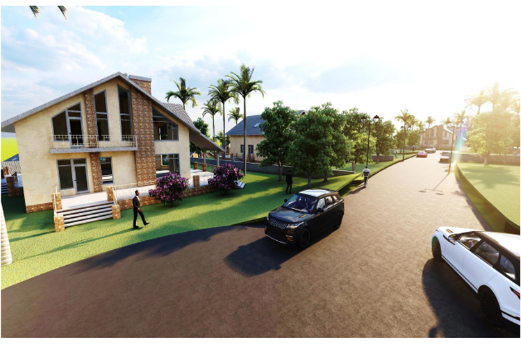
The Project Site is about 25 Acres with main approach road towards the South and at the highest point of the entire subdivision with average slope of about 1%. Two entry points are proposed at either ends of the approach road to the Project site. Power and Water are expected to be connected to the site from this approach road
The following tables provide assistance in interpreting the definition and categories of slope:
|
Flat |
Land with a slope gradient less than 5% |
|
Moderate Slope |
Land with a slope gradient of between 5% and 10% |
|
Steep |
Land with a slope gradient of between 10% and 15% |
|
Very Steep |
Land with a slope gradient of between 15% and 20% |
|
Extremely Steep |
Land with a slope gradient of more than 20% |
GRADING PLAN
Lot grading is the reshaping or sloping of the land in such a way that surface drainage from rainstorms, snowmelt or groundwater is directed away from the buildings and is controlled in a manner that eliminates or minimizes the impact on adjacent properties.
Master Lot Grading Plans specify design elevations, surface gradients, lot types, swale locations and other drainage information required for lot grading. An Overall Lot Grading Plan establishes the drainage relationship between adjacent properties and its approval is an effective basis for the control of lot grading.
Master Lot Grading Plan will be used to demonstrate that subdivision, as well as the subsequent development on lots created by the subdivision will respond to and respect the natural topography of the land. This will ensure that:
- Earthworks are minimised, and utilised to provide a suitable space for future buildings;
- The use of retaining walls is appropriate to the overall design of the subdivision, and takes into account the potential development on each lot;
- Drainage within the lots is considered and responds to the overall earthworks design of the development;
- Earthwork compaction is minimised to allow appropriate landscaping and allowance is made to ensure there is adequate space for landscaping post- construction, considering the extent of earthworks required;
- Ensures that any erosion from earthworks during construction is managed and mitigated and that the final built form mitigates against erosion;
- Excessive use of retaining walls is avoided, and if they are required, they are appropriately located, designed and respond to the surrounding amenity; and
- The height of free standing retaining walls is limited
Road Grading
The following key principles should be considered when designing subdivision on land that includes an existing pre-development slope of greater than 10%.
Design the street network to utilise the natural slope of the land, and consider how the street design will impact on the need for earthworks on lots accessing the street. In addition to this consideration, the design of the streets should also consider how the lots will be best designed to retain view lines to and from the ridgelines.
Street Design Principles
Streets should be designed to respond to the natural landform, and this means they will either be located:
-
-
- Following the contour line; or
- Directly up/down the slope.
-
Alternative solutions, such as a split level divided carriageway can provide site specific solutions to grade issues where appropriate.
In street design, the following key design criteria must be considered when deciding where to locate the streets:
- Streets following the contour: cross fall grade must be 10% or less unless interfacing open space.
- Streets up/down the slope: Preferred maximum longitudinal grade is 10%.
Lot Grading
Based on a street design solution that responds to the design criteria above, the lot and building solutions should be developed in conjunction with the earthworks design. This will enable a lot design solution that responds specifically to the topography, and allows for the most appropriate slope management methods to be used.
Lot design should respond to the street network design, and the topography of the land along the street:
1. Where streets are running up the slope, lot shapes should allow for building designs to manage the side to side fall of the lot through the minimsation of retaining wall height and benching between lots. This could involve wider frontages to allow for building separation and landscaping between lots, or could involve narrower lot frontages to minimise retaining wall heights and overall fencing heights on boundaries.